


Welcome to Cameron Pass. Just 65 miles west of Fort Collins, quiet and undeveloped “Cam Pass” receives a generous amount of snow each winter and stellar skiing often extends late into the spring. With relatively easy highway access, this area has become a favorite spot for day tours and overnight yurt trips from both sides of the range. From big lines, to mellow day tours and everything in between, this bundle puts the entire zone in your hands.
Together, the premier ski atlas and the waterproof, foldable topo map lay out 75+ routes, plus their approaches and exits, that make the terrain on Cameron Pass famous.
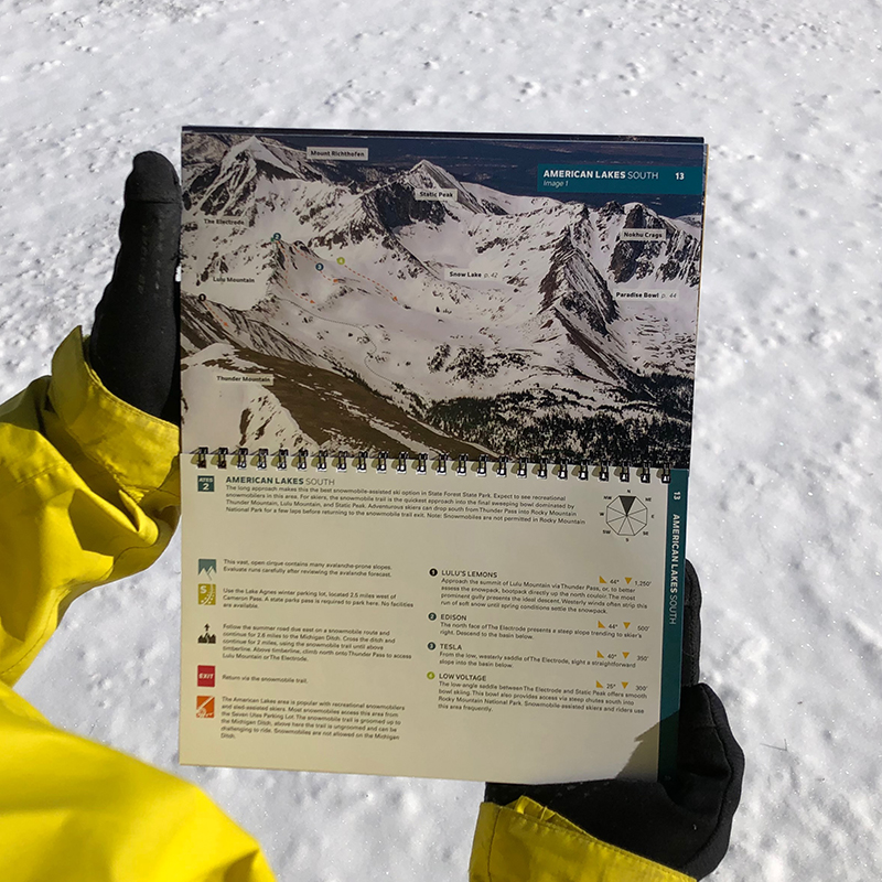
In the atlas, the author Rodney Ley has put his breadth of knowledge and 50 years of experience on Cameron Pass into this meticulously curated guidebook. The Cameron Pass zone boasts big lines, mellow day tours and everything in between, and this book will help increase your understanding of the terrain so that you can plan a successful and smart tour. You’ll find high-quality aerial photos and detailed descriptions to support real decision-making. Both the atlas and the map are lightweight and packable and include ascent and descent lines, resort boundaries, trailheads and parking info, Avalanche Terrain Exposure Scale (ATES) ratings, aspect, a run list, slope angles, descent lengths, and more.
Coverage includes the following zones:
Kelly Ridge, Ruby Jewel Cirque, Clark Peak, Sawmill Creek, Montgomery Pass North, Montgomery Bowls, North Diamond Peak, South Diamond Peak, Zimmerman Lake, Hot Dog Bowls, Enchanted Forest, Iron Mountain West, American Lakes South, Snow Lake Ridge, Paradise Bowl, Nokhu Crags North, Lake Agnes Bowl, Braddock Peak East, Braddock Peak West, Seven Utes Mountain East, Seven Utes Mountain West.
Included in this product bundle:
- Cameron Pass Ski Atlas: 5.5” x 8.5” spiral-bound guidebook with high-quality aerial photos marked with skintracks and descents and complete descriptions of terrain.
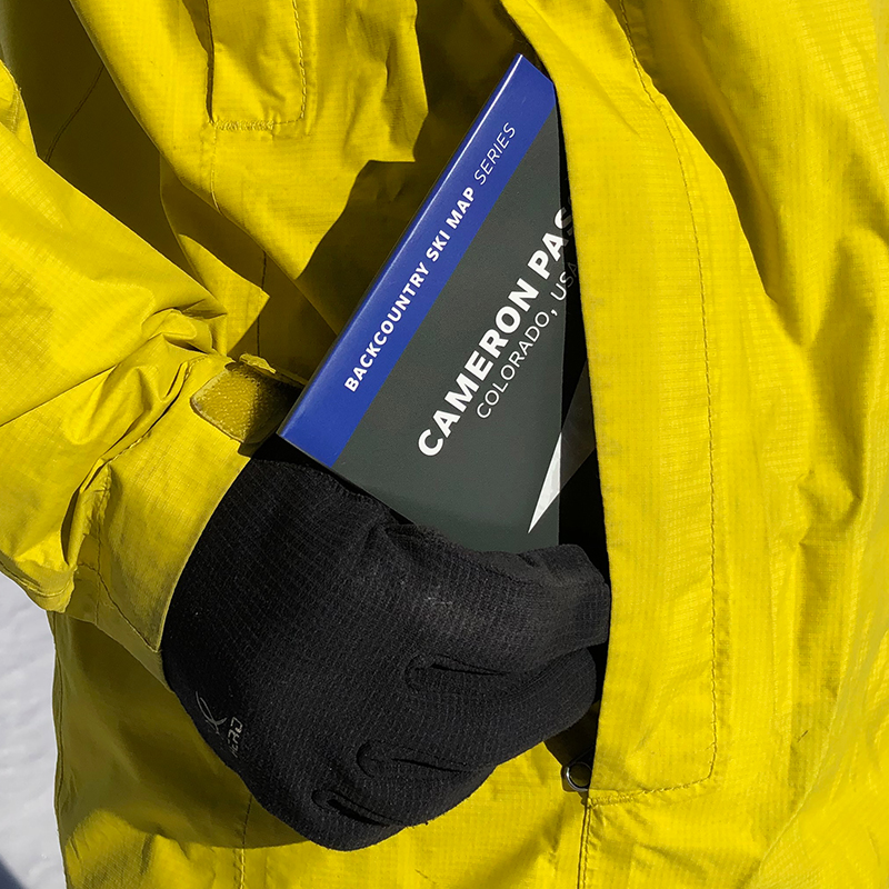
- Cameron Pass Ski Map: 18” x 22” 1:32,000 scale waterproof + tearproof topo map (4″ x 5.5″ folded, ~1.5 oz) with contour lines, landmarks and boundaries, and declination.
Designed to go with you on tour and built to pair with the OnX Backcountry App.
APP SOLD SEPARATELY.


