Free Shipping over $40

Shop

Backcountry Ski Map: Grand Traverse, Colorado

$18.00

PLEASE NOTE! The race is this week…so if you need this map for the 2023 race, it is now too late to reliably get it to you via mail. Cripple Creek Backcountry will be selling the maps at the gear check-in before the race. The Alpineer in Crested Butte and Rock N’ Roll Sports in Gunnison also carry the map and have it in stock. 
This compact topo map is your official map of the extraordinary Elk Mountain Grand Traverse point-to-point ski race! Your go-to tool for planning, training and racing.
FREE SHIPPING ON ORDERS OVER $40

Associated Products

Description

Put on by Crested Butte Nordic and taking place in late March/early April each year, Grand Traverse racers travel 40 miles and climb over 6,800 vertical feet across the Elk Mountain Range beginning in Crested Butte and ending at Aspen Mountain. Made for racers, this topo map shows the mountain terrain between Crested Butte and Aspen, through which the Grand Traverse route crosses, all in a lightweight and highly functional backcountry tool that satisfies the gear requirements of the race.

This backcountry map highlights the conditional route, the landmarks along the way, checkpoints specific to the race, and avalanche hazards as well as outlines etiquette for training. Backcountry huts on this map include, Fritz Benedict, Barnard, Goodwin Green, Opa’s Taylor, Markely, Lindley, Tagert, and Friends. 1:48,000 | 40′ CONTOUR INTERVAL.

To learn more about the race, head to TheGrandTraverse.org.

WATERPROOF | TEARPROOF | 1.5 OUNCES | 4″ X 5.5″ (folded) | 18″ x 22″ (open)

Additional information

Weight.4 lbs
Dimensions5.5 × 4 × 0.5 in
Lou Dawson
Lou Dawson@wildsnow
Read More
"This is the kind of publication that helps you arrive cold as an out-of-towner, find the “skinners” and have at it while pounding fluffy Colorado pow and laughing at the over-priced ski lifts."
West Elk Project
West Elk Project@westelkproject
Read More
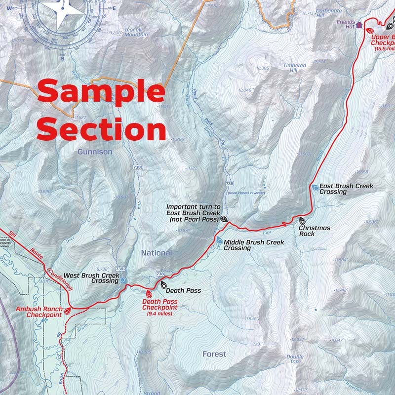
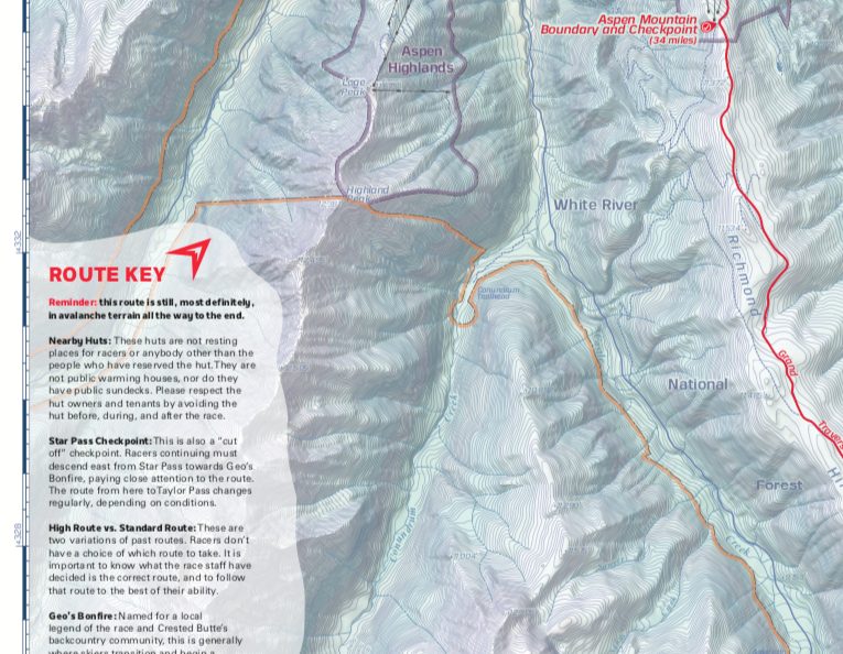
"It neatly lays out the elevations, descent lengths, aspects, trailhead directions, winter maintenance and parking info, snowmobile access, skin tracks, and exit info. That combined with helpful photos, give backcountry travelers a very good idea of what is going on."
Frank Konsella
Frank Konsella@14erskiers
Read More
"Sovick’s book contains established skin tracks, preferred routes, etiquette, and notes on terrain traps, gullies and avalanche paths. It also assumes all users are trained in avalanche avoidance and rescue, and includes AIARE’s “Communication Checklist,” which includes tips for facilitating teamwork and good decision-making."
Griff
GriffOn the Berthoud Pass Ski Atlas
Read More
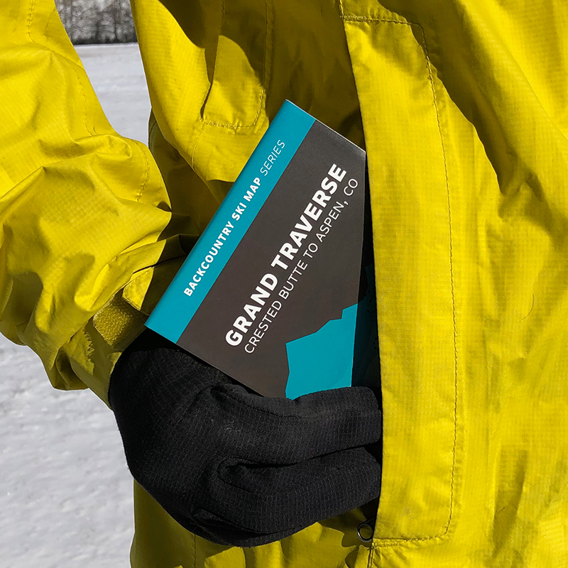
"These books are great for quick references, re-capping tours and pre-planning. They are small and light and pack well too."
Beau
BeauOn the Light Tours of Colorado Ski Atlas
Read More
"A well composed guidebook with lots of great suggestions, many of which I have already skied."
Regina
ReginaOn the Crystal Mountain Book
Read More
"Gifted this to my son at Christmas. He loved it! And it exceeded his expectations."
Mason
MasonOn the Snoqualmie Pass Ski Atlas
Read More
"I want to thank you for making the best ski guidebooks out there. Your books are a big reason why I’m able to explore the backcountry around Snoqualmie Pass."
Previous
Next